Saturday, May 21, 2011
Mike Bettes Visits Cheyenne NWS
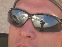
Mike Bettes from the Weather Channel came to Cheyenne NWS to get a briefing as well as talk about chasing possibilities for the week on Monday May 16th 2011


Thursday, May 19, 2011
Chasing Kansas Today
Wednesday, May 18, 2011
Funnel Cloud - Broomfield, CO
Saw an impressive funnel cloud from a very organized storm over Broomfield, CO today, it had a nice clear slot, and was rotating for about 30 min, called in the report and the sirens followed. Was a fun day with every weather element (besides a tornado I suppose), in commerce city it delayed the National College Lacrosse Tourney and thousand people went into shelter in the stadium as this went over the field. Was talkin to Skinner as he was on I-25 watching these storms, and he saw some good rotation as well.
Tuesday, May 17, 2011
May 17th 2011
Saturday, April 9, 2011
4-9-11 Local - Cheyenne, WY Small Hail
Skinner informed me that there was about 500 j of cape after 1pm today and to look for some convection. I was a little doubtful about anything that interesting due to the low energy, but the LI and helicity values did seem interesting. I left the house after a long day of developing convection over the hills as one cell was moving towards Cheyenne from the southwest. I went to a high spot I know and then got hit by blueberry sized hail, and saw some interesting convection indeed. Not bad for a chase at home literally.


Video Here:
http://www.youtube.com/watch?v=t84n3nqbcVg


Video Here:http://www.youtube.com/watch?v=t84n3nqbcVg
Thursday, November 18, 2010
Cold blasting gust front - Greeley, CO
Tuesday I left the house it felt about 55 degrees and felt warm and calm, I drove about 5 blocks noticing the clouds looking convective and intense. Very quickly it dropped what felt about almost 20 degrees and the winds were gusting an estimated 35 Knots. I took some pics of the convectiveness and the defined boundary and skinner archived these radar and sat for me after i texted him about it. You can see the crazy front on radar and what looks to even be some 35 dbz in there, possibly just some heavier rain, as it was raining. Later that evening it started to rain pretty hard and then sleet.
In the pics below you can see that the base of the clouds is defined in some, I was watching strong rising motion!, and also what sort of resembles mammatas clouds


In the pics below you can see that the base of the clouds is defined in some, I was watching strong rising motion!, and also what sort of resembles mammatas clouds


Tuesday, August 10, 2010
Largest Hailstone
Today I had the privilege to go down to Boulder at UCAR to see the Largest Hailstone in US History and could be the largest in Recorded World History. Thanks to Becca, and her friends in her line of work we were able to see this hailstone before it goes back to the owner for sale on ebay. We also got to see the replica of the Coffeyville, KS hailstone which was the previous record holder to the Aurora, NE hailstone, which we got to see slices of.
Subscribe to:
Posts (Atom)